Sign Our Petition
We've started a petition to the New York State Department of Environmental Conservation with the hope that they will change the dam classification of Ridgewood Reservoir, as well as, perform the area's wetlands mapping (we submitted an application 3 years ago). We need your help to get it off the ground.
Will you take 30 seconds to sign it right now? Here's the link:
http://www.change.org/petitions/new-york-state-department-of-environmental-conservation-change-the-classification-of-historic-ridgewood-reservoir
Here's why it's important:
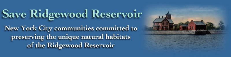
Save The Ridgewood Reservoir Wetlands
The New York City Department of Parks and Recreation (NYCDPR) is on the verge of executing its plan to decommission the Ridgewood Reservoir located on the Brooklyn–Queens border. The stated purpose is to have the reservoir reclassified from a Class "C" or "High Hazard" dam to a Class "D" or "Negligible or No Hazard" dam. The plan calls for two large breaches at the north end between each of the three basins and a third breach at the southwest end of the west basin. It also calls for the construction of a road from the south west corner to the north east corner of the west basin as well as ramps going into the east and central basins.
We oppose this plan. The Ridgewood Reservoir is not a dam and the work is unnecessary and a waste of taxpayer money. Furthermore this plan will destroy important wetlands.
Ridgewood Reservoir operated as a water supply for Brooklyn from 1858 to 1959. Its three basins were constructed using puddle clay and rocks from the surrounding area. It was decommissioned in 1990 by the New York City Department of Environmental Protection. Its basins were drained. The pumps were removed and the pipes filled with cement.
In its Permit Application, NYCDPR's consulting firm, GZA GeoEnvironmental, Inc., states "Ridgewood Reservoir is located on relatively high ground and hence no off-site drainage enters the impoundment. The dam’s watershed is therefore the former reservoir’s surface area of approximately 55 acres with the only unregulated inflow to the dam being the direct precipitation onto the reservoir." Included are two tables depicting water impounding scenarios. The first gives the estimated water depths of each basin in their existing condition for both a 100-year peak inflow of 9 inches and a 72 hr 1/2 Probable Maximum Precipitation (PMP) of approximately 39.1-inches. The second table gives results after breaching. In neither scenario does the water level rise during a 100-yr storm to 155.5 feet above sea level, which is 1 foot above the toe of the dam, and therefore would seem to conform with the NYSDEC's recommendation for Class "D". Even a rainfall of 39.1 inches (1/2 PMP) would be insufficient to fill the west basin to the lowest point of the proposed downstream breach, thus making that breach, as well as the proposed road, superfluous. Why this number is even considered goes unexplained. This seems remarkable given that 39.1 inches exceeds the annual Ridgewood rainfall!
In reference to the west basin GZA mentions, "It should be noted that based on historic orthophotographs and site observations, it appears as though under current conditions runoff from storm events infiltrates through the basin bottom and does not typically create a significant impoundment in the West Basin." This comes as no surprise because, once drained of water, an impounding structure made of puddle clay looses its integrity. In 2011, two six-foot deep test pits dug in the west basin actually revealed no puddle clay, only soil.
The preliminary assessment, prepared by Round Mountain Ecological LLC for NYCDPR, noted that "Our surveys of the flora and fauna of Ridgewood Reservoir in 2007 found the site to be highly significant for the biodiversity of New York City and the region. The site is home to more than 100 native plant species, three of which are listed as Threatened or Endangered in New York State, and more than 125 bird species, seven of which are listed as Threatened or Special Concern." It identifies important wetland in the south end of the west basin through which NYCDPR intends to build a road. Concurring with the preliminary assessment, the NYCDPR Environmental Assessment Statement (EAS) states "A DPR Natural Resources Group (NRG) entitation conducted in 2005 identified good-quality native plant communities and/or wetlands in the souther end of Basin 3, which is also the area where the majority of Threatened or Endangered plants were found in this basin. Field visits were performed by ecologists from NRG on May 15 and May 29, 2014 which confirmed that the wetland characteristics in the southern portion of Basin 3 identified by Round Mountain Ecological are still present." It is this section through which NYCDPR will build a road. The EAS states that only a tiny portion of the wetland in the west basin will be impacted. However, Appendix B of the Permit Application contradicts that statement. It authorizes the contractor to remove all water which it determines will have "...the potential to create a deleterious effect on the Work." Furthermore it states "Groundwater levels in excavations shall be maintained at least two feet (2’) below subgrade." The assumptions made in the EAS which lead to the conclusion of only 0.3 acres of wetland disturbance is therefore simply in error. To build a road as it is currently designed, the entire wetland ecosystem will be compromised and could even be destroyed.
The EAS, NRG, Round Mountain Ecological LLC, and certified wetland delineator, Mickey Cohen, are all in agreement that all three basins of the Ridgewood Reservoir contain wetlands. However, the EAS states that NYSDEC is not obligated to protect these wetlands. We strongly disagree. The wetland, which will be compromised by the road in the west basin, contains endangered and threatened plant species. Warblers, Vireos and Woodcock breed in that basin. The claim, that wetlands under 12.4 acres per ECL Article 24 Section 24-0301 need not be protected, is clearly contradicted by passages within that same section as well as other sections which specifically address the importance and the need for conservation of wetlands falling under 12.4 acres. Indeed, the claim is contradicted by the declaration of public policy contained in Section 24-0103. Despite this stated commitment to preserving wetlands, NYSDEC has yet to act on the application for wetland protection submitted three years ago. Meanwhile, it has approved the NYCDPR's plan for decommissioning the reservoir.
We request that this project be halted until NYSDEC acts upon the application for protection of this important resource. According to NYCDPR, New York City has lost over 99% of its original 224,000 acres of freshwater wetland. Ridgewood Reservoir does require the full consideration of the NYSDEC.
We further request that NYSDEC review its decision making process for hazard designation. This project will waste at least $6 million taxpayer dollars to reclassify Ridgewood Reservoir as a class "D" structure when it appears that it already is a class "D" and in the process it will damage a wetland which NYSDEC was in part created to protect.
Lastly, we request NYCDPR reconsider the proposal offered by the Highland Park/Ridgewood Reservoir Alliance back in 2008. NYC has unintentionally created an environmental wonder. Turn Ridgewood Reservoir into a Nature Preserve. Renovate the pump houses as Visitor Interpretive Centers. Share the woodland and wetland experience of the east and west basins by adding controlled boardwalks. There is no other place like this is New York. Make the commitment. Make Ridgewood Reservoir a destination, a success story. Don't destroy it!
You can sign our petition by clicking here.
Send us an email


No comments:
Post a Comment